Padthaway Water Allocation Plan
If you have a water licence or are looking to get a licence in the Padthaway area you should understand the Padthaway Water Allocation Plan.
Padthaway Water Allocation Plan [PDF, 4.6 MB]
The Limestone Coast Landscape Board developed the Padthaway Water Allocation Plan in consultation with the Padthaway Stakeholder Advisory Group, the Department for Environment and Water and other interested groups and individuals.
Resource condition update for the Padthaway Prescribed Wells Area
Under the Padthaway Water Allocation Plan 2025, resource condition is assessed annually against the adaptive management framework.
Objectives of the Padthaway Water Allocation Plan
The objectives of the Padthaway Water Allocation Plan are to license, allocate and manage water in a manner which:
- Provides security of water access entitlements to users of the resource.
- Minimises the impact of taking water on the resource, other water resources, groundwater dependent ecosystems and existing users.
- Manages the resources within acceptable resource condition limits to maintain economic, environmental and social needs.
- Maintains groundwater dependent ecosystems at a low level of risk.
- Maintains the cultural values and needs of First Nations people.
The guiding principles are to:
- Manage the water resources of the unconfined aquifer so that they continue to be available for the social, economic, environmental and cultural needs of current and future generations.
- Protect the resource locally, in each management zone and the entire area.
- Provide flexibility and equity in access to the water resource of the unconfined aquifer.
- Recognise and incorporate the traditional knowledge of First Nations people in the management of the resource and groundwater dependent ecosystems.
- Maintain the availability of water to groundwater dependent ecosystems.
- Protect the environment by ensuring that the taking and use of water from the unconfined aquifer does not cause significant degradation of any other resource e.g. soils.
- Provide principles so that water allocations are available to sustain economic development.
- Allow the Padthaway community and stakeholders the opportunity to self-regulate and manage their water use within acceptable limits.
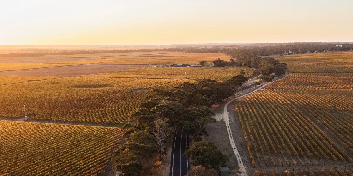
Water resources in the Padthaway Prescribed Wells Area
Water resources in the area consist of an unconfined aquifer and a confined aquifer. The upper unconfined aquifer is recharged through rainfall. A thick clay sits under the unconfined aquifer preventing recharge into the confined aquifer and connectivity between the aquifers.
The Padthaway Prescribed Wells Area supports just over 100 water licences.
Water resource in the unconfined aquifer
The unconfined aquifer is the primary water resource used in the area for public water supply, irrigation, recreation and industry. The unconfined aquifer is fully allocated. It is divided into two management zones, the Padthaway Flats and Padthaway Ranges.
Groundwater flows in a west to north-west direction from the Naracoorte Range, towards and along the flats in the west. The unconfined aquifer in the flats area generally has high well yields. Depth to water tends to range between two and six metres.
The unconfined aquifer in the ranges area to the east tends to have lower well yields and can produce fine sand when pumped.
Salinity in the Padthaway Prescribed Wells Area in the unconfined aquifer
Groundwater salinity trends are variable across the Padthaway Prescribed Wells Area. Some wells have shown declining or stable salinity trends whilst others have displayed an increasing salinity trend. Increasing trends in groundwater salinity are a combination of processes, including:
- Clearance of native vegetation between the 1950s and 1970s. This resulted in the flushing of salts from the unsaturated zone in the Padthaway Range. The natural underground water flow has mobilised this historic salt load into the Padthaway Flats.
- Evaporation and drainage of irrigation water (irrigation re-cycling) under flood irrigation.
- Flushing of high salinity soil under drip and pivot irrigation during periods of high rainfall.
- Evapotranspiration of groundwater where the water table is shallow.
The groundwater salinity in the Padthaway Flats ranges from 1,700 μS/cm to 3,700 μS/cm. It becomes far more saline (7,800 μS/cm to 15,800 μS/cm) toward the western margins.
The groundwater salinity in the Padthaway Range is generally lower than in the Padthaway Flats. Salinity ranges from 1,800 μS/cm to 3,100 μS/cm.
A changing climate and the Padthaway Prescribed Wells Area
Climate is the primary driver of trends in groundwater levels in the Padthaway Prescribed Wells Area. This is especially evident in the Padthaway Flats. Historical groundwater levels show seasonal fluctuations of up to 2 m in the Padthaway Flats. In the Padthaway Ranges groundwater water levels are more consistent.
The Padthaway Water Allocation Plan has an adaptive management framework to respond to a changing climate. This allows for transparent management responses if the resource condition declines. Development of the adaptive management framework used a groundwater model, stock and domestic well vulnerability analysis and community knowledge and input.
History of the Padthaway Water Allocation Plan
The current version of the Water Allocation Plan for the Padthaway Prescribed Wells Area was adopted on 20 May 2025.
It replaced the Padthaway Water Allocation Plan that was adopted 26 April 2009. The first Padthaway Water Allocation Plan was adopted on 14 October 2001.
Assistance with your water licence or the water allocation plan
The Department for Environment and Water administers water licences for South Australia. mywater is South Australia’s 24/7 online water management system and customer portal. You can access information about your licence and access a range of water services such as applying to transfer water or applying for a permit to put a bore in. For support in using the mywater portal contact the mywater Contact Centre at dew.mywater@sa.gov.au or call 08 7133 7333 during business hours.
If you need any other assistance with your water licence contact the water licensing team at DEW.LCWaterLicensing@sa.gov.au or call 08 8735 1134. The Water Licensing team are located at 152 Jubilee Highway East, Mount Gambier, 5290.