Morambro Creek and Nyroca Channel Water Allocation Plan
If you have a water licence or are looking to get a licence for Morambro Creek you should understand the Morambro Creek and Nyroca Channel Water Allocation Plan.
The Morambro Creek and Nyroca Channel Water Allocation Plan aims to ensure that the surface water resource is allocated and managed in a sustainable manner. To achieve this, the Morambro Creek and Nyroca Channel Water Allocation Plan:
- Identifies how much water can be taken from the resource, when it may be taken and from where it may be taken.
- Protects the watercourse by limiting development around it.
- Provides water for water dependent ecosystems in the prescribed area, the Marcollat Watercourse and underlying aquifer.
Morambro Creek and Nyroca Channel Water Allocation Plan [PDF, 2.5 MB]
The Limestone Coast Landscape Board develops and maintains water allocation plans as outlined in the Landscape South Australia Act 2019. The plans are developed with environmental, social, cultural and economic needs in mind and seek to ensure long term sustainability and security of the resource.
Water resources in the Morambro Creek Prescribed Watercourse
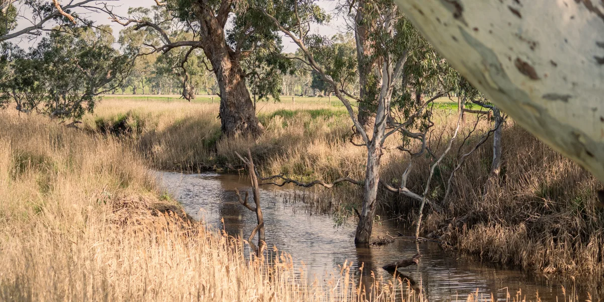
The headwaters of Morambro Creek are located in the western part of the Wimmera region of western Victoria. The creek flows from Victoria into the Upper Limestone Coast near Frances. It then flows westerly to Cockatoo Lake, approximately 26 kilometres north east of Naracoorte. Morambro Creek captures water from throughout its catchment, including the Wimmera and the Frances area in South Australia. Cockatoo Lake is one of few permanent inland water bodies in the Limestone Coast and is an important waterbird refuge. It is also important to the local community for recreational water skiing and boating. Water then flows along the Nyroca Channel and passes through the Harper Range discharging into the Marcollat Watercourse. The Prescribed Area covers a catchment area of approximately 22,487 hectares (225 km2), and includes 30 km of the Nyroca Channel.
Morambro Creek is an ephemeral stream with highly variable flows as is typical of watercourses in the Limestone Coast.
There are four water licences in the Morambro Creek and Nyroca Channels Prescribed Area with no further water available for allocation.
History of the Morambro Creek and Nyroca Channel Water Allocation Plan
The Morambro Creek Prescribed Watercourse was prescribed in April 2001. It was prescribed in response to an increase in demand for water for aquifer recharge schemes. These schemes were to address the increasing salinity of the adjacent water resources in the Padthaway Prescribed Wells Area. The Morambro Creek and Nyroca Channel Water Allocation Plan was adopted in January 2006. In 2011 a minor review occurred with an outcome to continue the Plan on. It is now due for another review.
Assistance with your water licence or the water allocation plan
The Department for Environment and Water administers water licences for South Australia. mywater is South Australia’s 24/7 online water management system and customer portal. You can access information about your licence and access a range of water services such as applying to transfer water or applying for a permit to put a bore in. For support in using the mywater portal contact the mywater Contact Centre at dew.mywater@sa.gov.au or call 08 7133 7333 during business hours.
If you need any other assistance with your water licence contact the water licensing team at DEW.LCWaterLicensing@sa.gov.au or call 08 8735 1134. The Water Licensing team are located at 152 Jubilee Highway East, Mount Gambier, 5290.